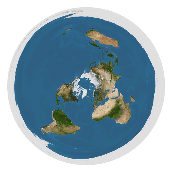

The researching becomes much faster to do with this tool since you have the cities and the standard times ready on the map (just hover the cursor upon the red dots for two secs and the pop-up title will show you the name of the city and the UTC/GMT). I want to encourage you to use the sites and (or other similar sites) with the map above (with cities and times) to understand better that there are fake flights to disprove the flat Earth map. At the same time, you can also see and understand, that the fictional "non-stop flight times" between the southern continents makes no sense at all (in the Southern Hemisphere). The purpose is to make it easier and faster for researchers and skeptics to find out that the flat Earth map makes a lot of sense when they compare the standard times between the cities.

There are a few reasons to have the 100 links (hotspots) on the map. The purpose to have the cities on the Flat Earth map: To be more precise the continents have the same shape on both maps, and the distance between the continents are also the same.

It has a lot of similarities to the logo of the United Nations. The flat Earth map is a projection (azimuthal equidistant projection) of the fictional spherical Earth. The original map was a bit smaller, so I changed the size to 816 X 816 pixels. I am the admin of this site (The hotspots on the Image Map above represent 100 different cities spread all over the world. The red hotspots on the map, with links to, they are added by me, Pete. The Flat Earth map which I have used in this project is made of Trekky0623 and have been transferred from en.wikipedia to Commons by MathiasRav.


 0 kommentar(er)
